Click here to read this story by Julia Rosen in the Los Angeles Times (Science Now)
Click here to read the final report published in Water Resources Research (American Geophysical Union).
The purpose was to provide science to the Department of Energy to ensure that Moab’s radioactive waste pile would be removed from the floodplain of the Colorado River, which is indeed happening. So far, 41% of the pile has been removed and taken by railroad to a burial site 30 miles north of town at a place called Crescent Junction adjacent to the I-70 corridor.
Highlights of this report include:
River: Upper Colorado River (above the Green River confluence and below the Dolores River, the last major tributary)
Site location: 10.5 miles above the Moab Bridge
Time frame: The last 2,140 years (+/- 220 years)
Number of floods: 44
Range of floods in cfs: 60,036 to 349,616
34 to 40 floods have exceeded the magnitude of the USGS 100-year flood determination
20 - 25 floods have exceeded the magnitude of the USGS 500-year flood determination
5 floods have exceeded a peak discharge of 282,000 cfs The two largest floods were slightly over 349,000 cfs
Most of these floods have occurred in the last 500-years
The 100-year flood would have a peak discharge ranging from 156,440 to 179,050 cfs
The 500-year flood would have a peak discharge ranging from 224,780 to 265,570 cfs
A 1000-year flood would have a peak discharge ranging from 256,740 to 310,770 cfs
ADDITIONAL INFORMATION
1) Click here - To read the report of 2006 that fulfilled the requirements of the grant that supported the preliminary research for this paleoflood research project.
2) Updated Report (2006b)
3) Moab Mill Project Cover Letter
4) Moab Mill Project Brochure
5) Moab Mill Project Poster
6) "Investigation of the Hydrogeologic Connection between the Moab Mill Tailings and the Matheson Wetland Preserve," Philip Gardner and D. Kip Solomon, Department of Geology and Geophysics, University of Utah, December 11, 2003 (with Addendum) [PFD 8.3m]
7) Initial-Phase Investigation of Multi-Dimensional Streamflow Simulations in the Colorado River, Moab Valley, Grand County, Utah, 2004, Terry A. Kenney, US Geological Survey
8) Special newspaper supplement from the TIMES-INDEPENDENT about the Moab Mill Project
9) Special presentation by Dr. John C. Dohrenwend given at the Moab Information Center in 2006
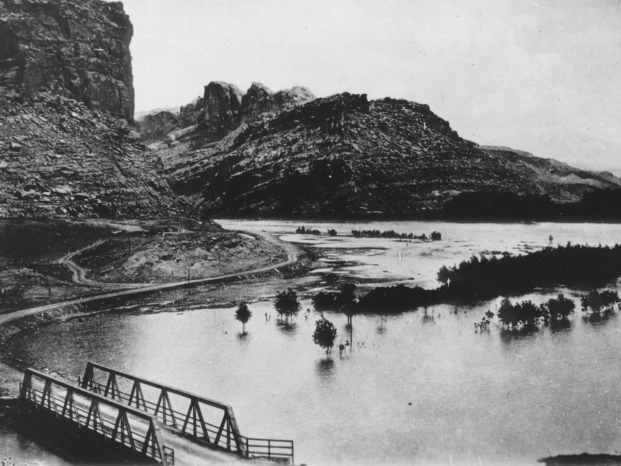
10) Photo of Colorado River in flood (1917 or 1921) near the Colorado River bridge
11) Paleoflood study of Colorado River at Grand Canyon by O'Conner et al., 1994
12) Click here to read Dam Failure Inundation Study by the Bureau of Reclamation (1998).
13) Click here to learn more about the flood of 1884 and the flood of 1983
